
CAREERS ENCYCLOPEDIA

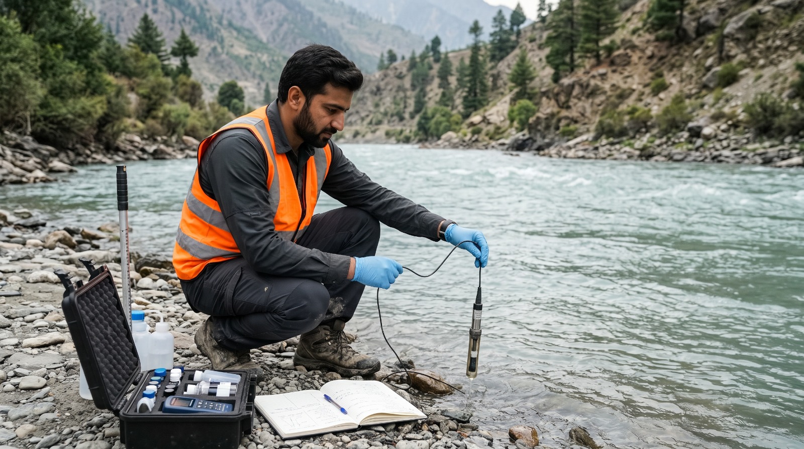
Hydrologist
A Hydrologist studies the movement, distribution, quality, and availability of water on Earth. Hydrologists analyze rivers, lakes, groundwater, rainfall, and watersheds to support water supply, flood management, irrigation, environmental protection, and sustainable water resource planning.
- Measure and monitor river flows, rainfall, groundwater levels, and water availability.
- Collect water samples and analyze water quality data.
- Study watersheds, drainage systems, and groundwater movement.
- Analyze rainfall patterns, droughts, floods, and seasonal water changes.
- Develop models to estimate water availability and predict water-related risks.
- Prepare maps, technical reports, and research findings.
- Support irrigation, dam planning, drainage, and water supply projects.
- Recommend strategies for sustainable water use and conservation.
- Coordinate with engineers, environmental scientists, and government departments.
- Monitor water resource projects and ensure compliance with environmental standards.
Hydrology and Water Systems
- Water cycle, precipitation, evaporation, infiltration, and runoff.
- River systems, watersheds, groundwater, and aquifers.
- Surface water and groundwater interactions.
Water Quality and Environment
- Water chemistry and pollution sources.
- Environmental impacts of water use and development.
- Water conservation and ecosystem protection.
Climate and Water Resource Planning
- Rainfall patterns, droughts, and floods.
- Climate change impacts on water availability.
- Water resource assessment and management.
Water Data Collection and Analysis
- Measure river flow, groundwater levels, and rainfall.
- Interpret hydrological data and identify trends.
- Conduct water sampling and basic quality assessments.
Technical Modeling and Mapping
- Use GIS and remote sensing for watershed analysis.
- Apply hydrological models to estimate runoff and flooding.
- Prepare maps, graphs, and technical reports.
Research and Communication
- Write scientific and technical reports.
- Present findings to engineers, planners, and decision-makers.
- Coordinate field surveys and research activities.
Analytical Ability
- Interpret complex water and climate data.
- Identify patterns in rainfall, runoff, and groundwater movement.
- Evaluate possible water-related risks.
Spatial and Technical Ability
- Understand terrain, watersheds, and drainage networks.
- Work with maps, scientific instruments, and modeling software.
- Visualize water movement across landscapes.
Fieldwork and Problem-Solving
- Conduct fieldwork in different weather and terrain conditions.
- Make evidence-based recommendations.
- Adapt research methods to changing environmental conditions.
Hydrologists are generally curious, analytical, careful, and environmentally conscious. They do well at jobs that need:
Attention to Detail
Scientific Curiosity
Critical Thinking
Patience and Persistence
Environmental Responsibility
Teamwork and Communication
Hydrological Monitoring Equipment
- Rain gauges, flow meters, water-level sensors, and groundwater monitoring equipment.
- Water sampling kits and water quality testing instruments.
- GPS devices and field data collection tools.
Mapping and Modeling Software
- ArcGIS and QGIS for watershed mapping.
- HEC-HMS and HEC-RAS for hydrological and flood modeling.
- Remote sensing tools and satellite-based rainfall datasets.
Data Analysis and Reporting
- Microsoft Excel and statistical software.
- Python or R for scientific data analysis.
- Database and report preparation tools.
- Complete Intermediate or FSc, preferably with Pre-Engineering or Pre-Medical subjects depending on the university's admission criteria.
- Obtain a bachelor's degree in Hydrology, Water Resources, Environmental Science, Geology, Geography, Earth Sciences, or a related field.
- Develop knowledge of water systems, environmental processes, and scientific data analysis.
- Learn GIS, remote sensing, and hydrological modeling tools.
- Gain practical experience through fieldwork, laboratory work, or internships.
- Develop report writing, research, and communication skills.
- Pursue a master's degree for specialized research or senior technical positions.
- Meet the specific requirements of the employer or research institution.
Hydrologists can work in water resource management, environmental consulting, irrigation, flood forecasting, climate research, groundwater assessment, and infrastructure planning. In Pakistan, water scarcity, changing rainfall patterns, flooding, and growing demand for water management create opportunities in government departments, research organizations, consulting firms, and development projects.
- Water and Power Development Authority (WAPDA).
- Pakistan Council of Research in Water Resources (PCRWR).
- Provincial irrigation and drainage departments.
- Pakistan Meteorological Department.
- Environmental protection agencies.
- Water supply and sanitation organizations.
- Environmental and engineering consulting firms.
- Agricultural research and irrigation projects.
- Universities and scientific research institutions.
- Climate change, disaster management, and flood risk projects.
- International development organizations and water conservation programs.
- Private companies involved in dams, groundwater, and infrastructure projects.
- Intermediate or FSc with subjects accepted by the chosen university.
- Bachelor's degree in Hydrology, Water Resources, Environmental Science, Geology, Earth Sciences, or a closely related discipline.
- Master's degree in Hydrology, Water Resources Management, Hydrogeology, or Environmental Science for advanced roles.
- Training in GIS, remote sensing, and watershed mapping.
- Courses in hydrological modeling, water quality, and climate data analysis.
- Fieldwork and research experience.
- PhD for advanced academic and specialized research positions.
- Quaid-i-Azam University, Islamabad: Relevant programs in Earth Sciences and environmental research.
- University of the Punjab, Lahore: Relevant programs in Geography, Geology, and environmental sciences.
- University of Peshawar: Relevant programs in Geology, Geography, and environmental studies.
- COMSATS University Islamabad: Relevant environmental and earth-related programs, depending on campus offerings.
- University of Agriculture Faisalabad: Relevant programs in water management and agricultural water resources.
- National University of Sciences and Technology (NUST): Relevant environmental and civil engineering programs.
- Pakistan Council of Research in Water Resources (PCRWR): Water-related research and training opportunities where offered.
- Water and Power Development Authority (WAPDA): Relevant technical and research opportunities, depending on recruitment and training programs.
- Public university bachelor's degree: approximately PKR 60,000 to 300,000 per year.
- Private university bachelor's degree: approximately PKR 180,000 to 800,000 per year.
- Master's degree: approximately PKR 150,000 to 700,000 in total, depending on the institution and program duration.
- GIS and remote sensing courses: approximately PKR 10,000 to 50,000.
- Hydrological modeling and water resource training: approximately PKR 10,000 to 60,000.
- Books, field equipment, and learning materials: approximately PKR 10,000 to 40,000 per year.
- Field surveys and travel: approximately PKR 10,000 to 60,000 per year, depending on course requirements.
- Scholarships and financial assistance: approximately 25% to 100% tuition support may be available through university merit scholarships, need-based aid, HEC-supported schemes, and other eligible funding programs.
- Research assistantships or funded postgraduate positions may be available for eligible students.